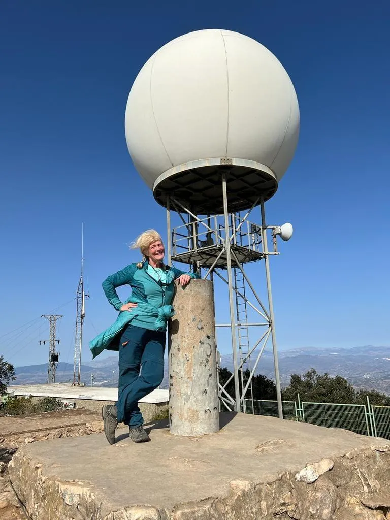
Pico Mijas Summit

Join me in 2022
Join the
Machu Picchu Trips
Facebook Group
for all the details
Atrévete
Facebook Group
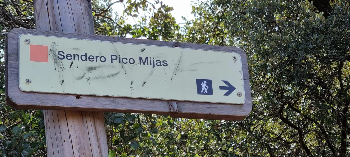
Hiking: Pico Mijas
Written by Tina Sibley in January 2022
HIKING IN THE SPANISH HILLS: Pico Mijas
I took on the challenge of this hike on 29th January 2022 as part of my final training to climb Kilimanjaro and it was wonderful preparation.
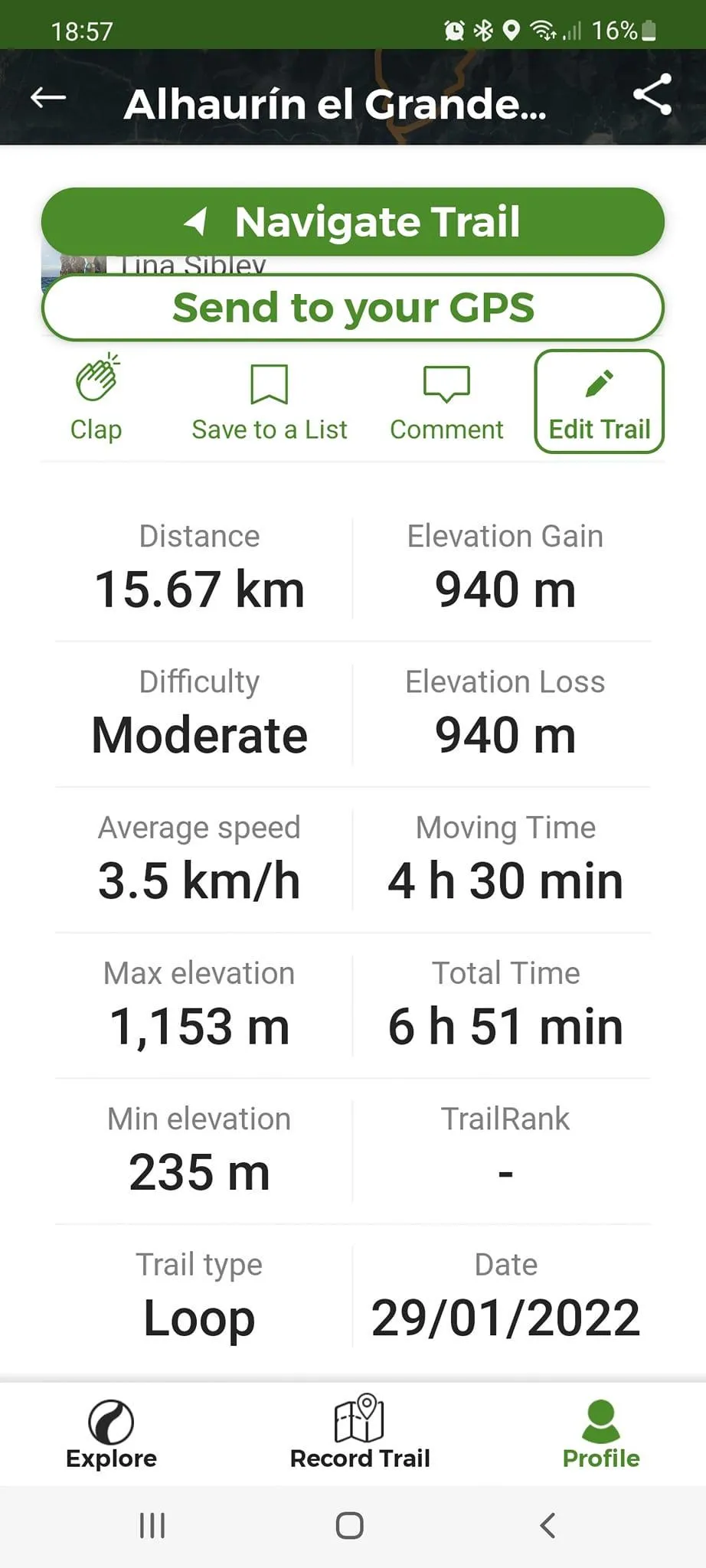
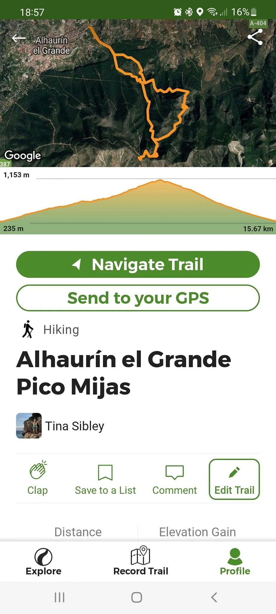
With the exception of the mighty Mulhacen the following week, it was the longest of my preparation hikes at 15.67 km and had the biggest elevation gain - at 940m.
It was also my favourite and I would do it again in a heartbeat!
Pico Mijas is in the Sierra de Mijas range and is known as one of the most
beautiful hikes in the Malaga region – I can certainly vouch for that.
Having learned my lesson not to go with an organised group of super fast
hikers, this time I assembled a small group of hiking buddies that I knew well
and who I knew would be happy to go at an easier pace.
We planned on setting off early so we had time without needing to stress about losing the daylight. Our starting point was near the town of Alhourin el Grande and we found a very easy parking spot right next to a restaurant.
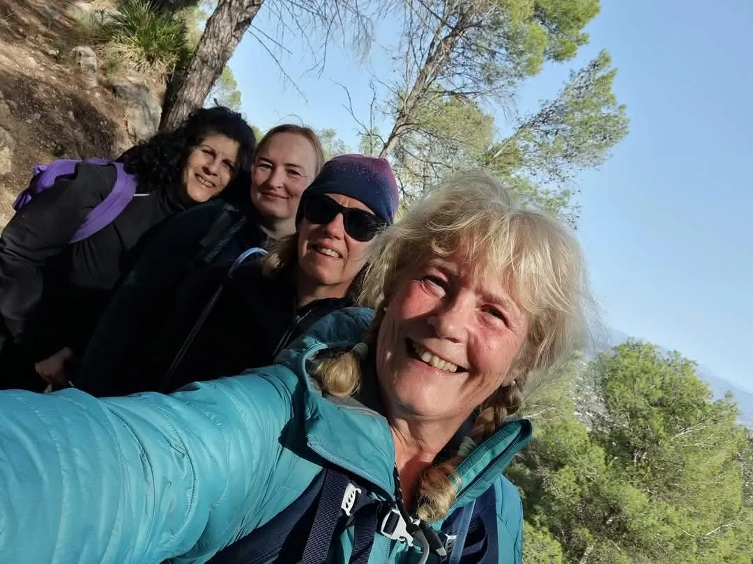
There were only four of us and we had all done a lot of hiking between us, one
of us having done this particular route before.
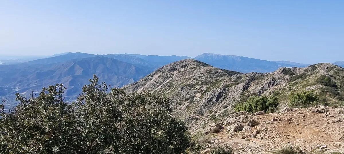
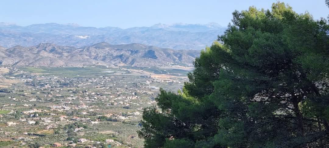
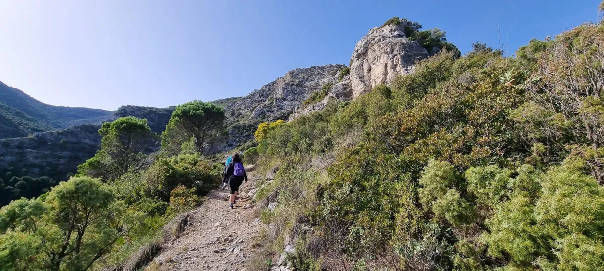
We had the absolute perfect day, bright and sunny with clear skies so we could see for miles and miles.
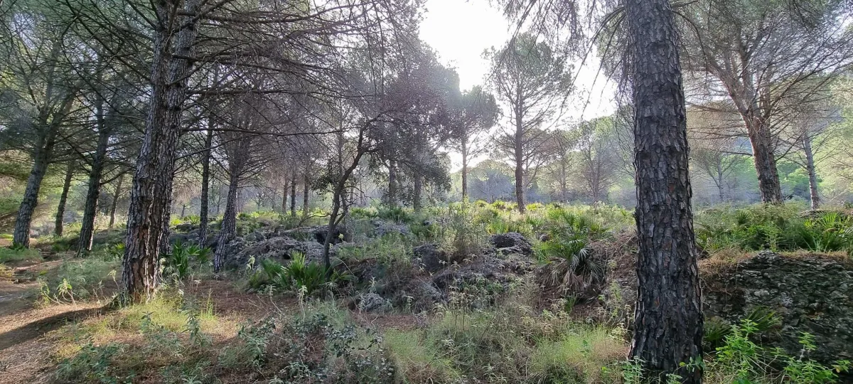
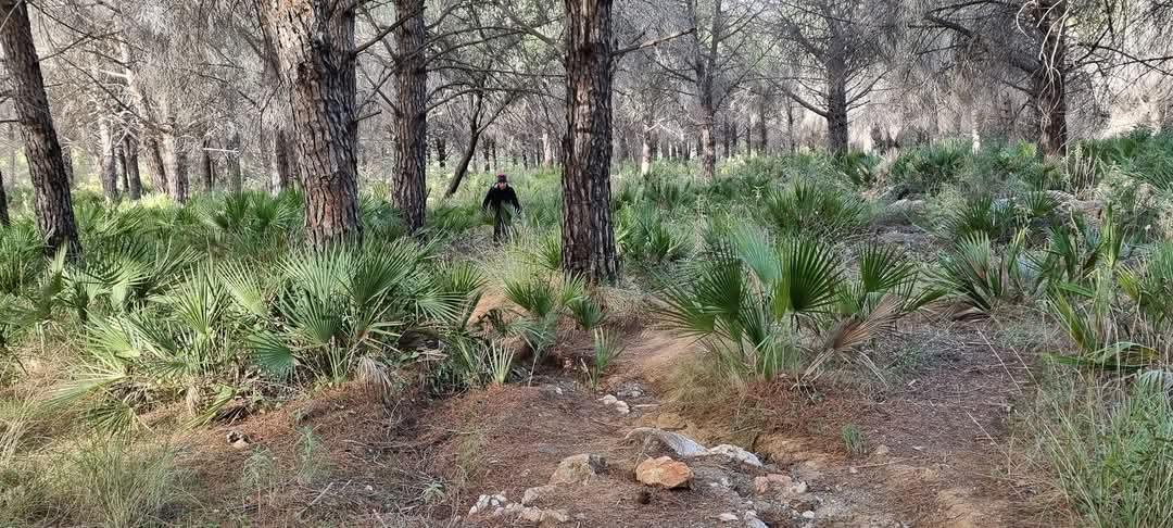
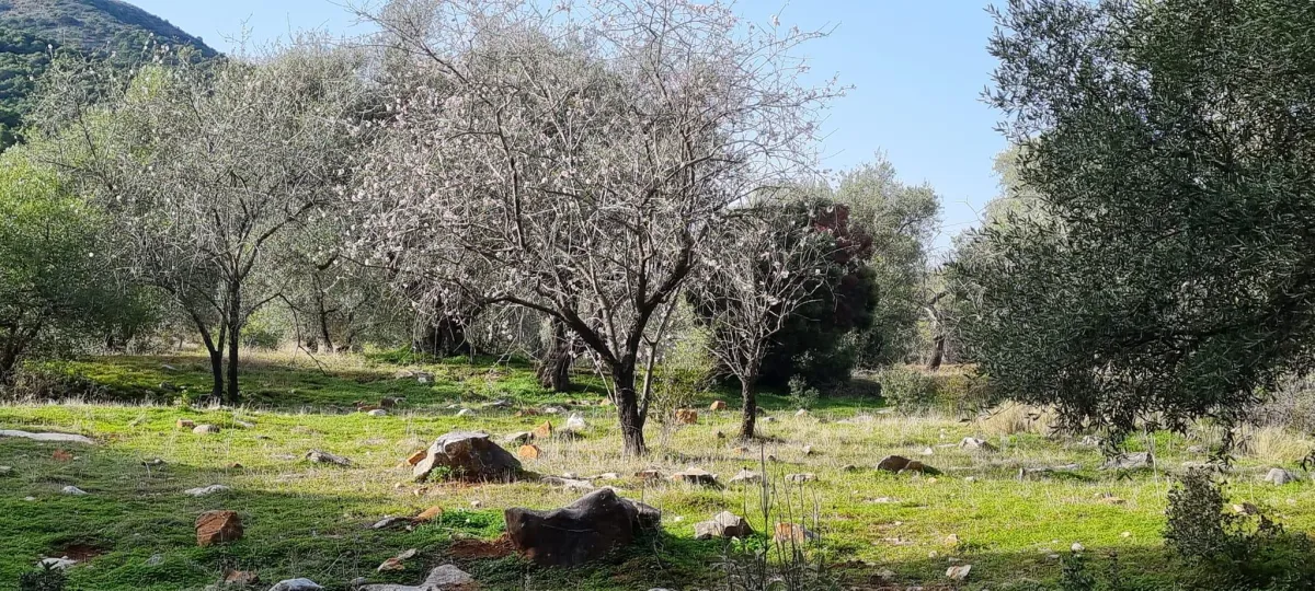
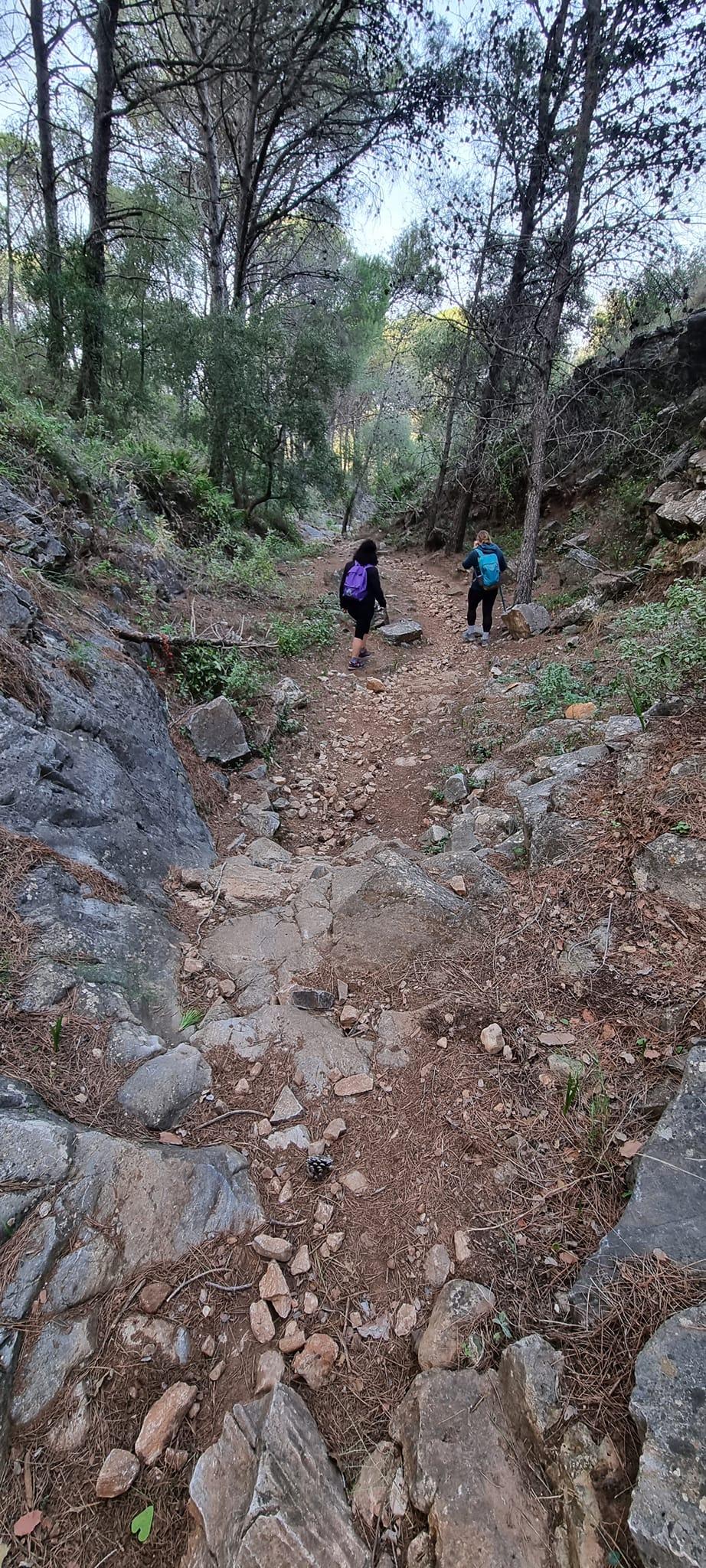
We started our way up from the road and before long were going through the most gorgeous scenery, through lush pine forests.
Even though our total elevation gain was large, at 940m because this was spread over a long distance, it didn’t feel as steep as some of the other hikes.
Also, as we all knew each other pretty well, we were chatting and laughing so
the time passed pleasantly and we were able to catch our breath, enjoy the
views and take photos.
On our way up, we were rewarded with spectacular views of the coast, with blue skies and seas, and the incredible mountains.
Unlike La Concha, this wasn’t mega-scary with lots of drop offs. There was just one that got my heart racing a little. The narrow path crossed a kind of ravine with a bit of a drop and skirted around a bush. My courage kind of deserted me and I found myself clinging onto this bush halfway across, not wanting to move. There was no option but to dig deep and go for it, and the others helped haul me across! Once that part was done, there were no other scary parts at all, much to my relief!
We found a nice spot under some trees and took our time having lunch and re-charging our batteries, before heading on up to the summit.
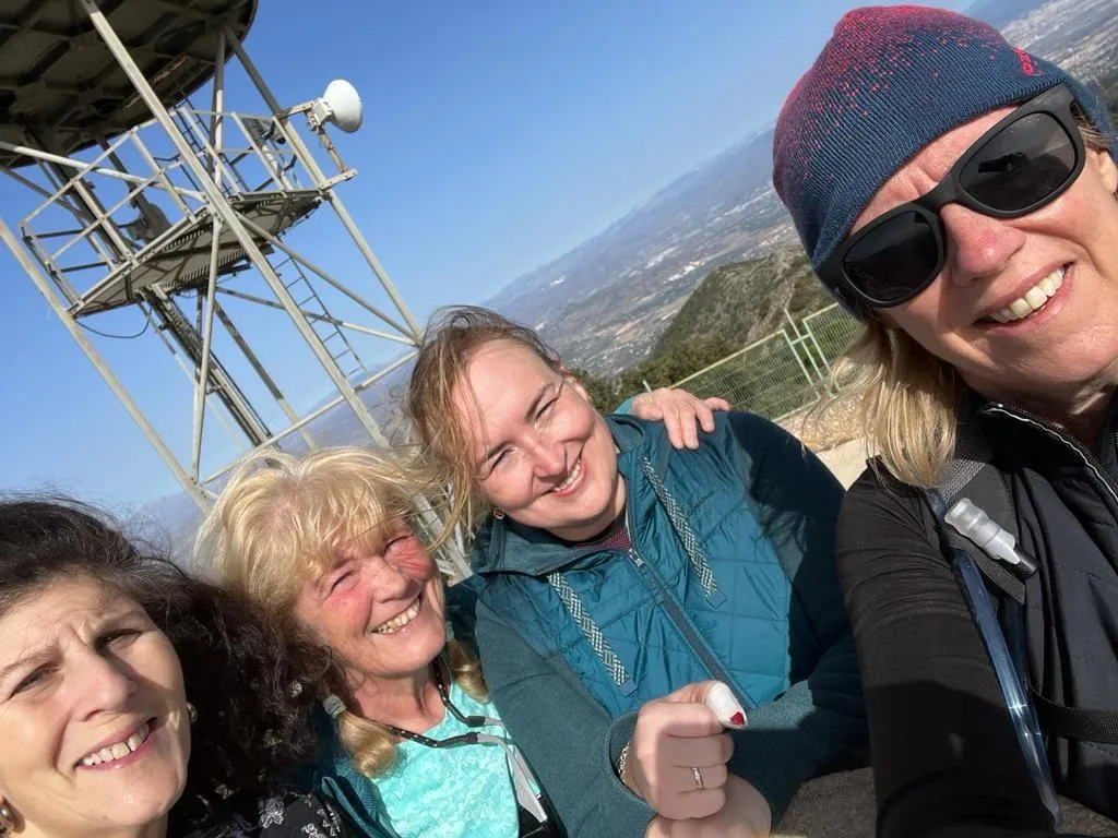
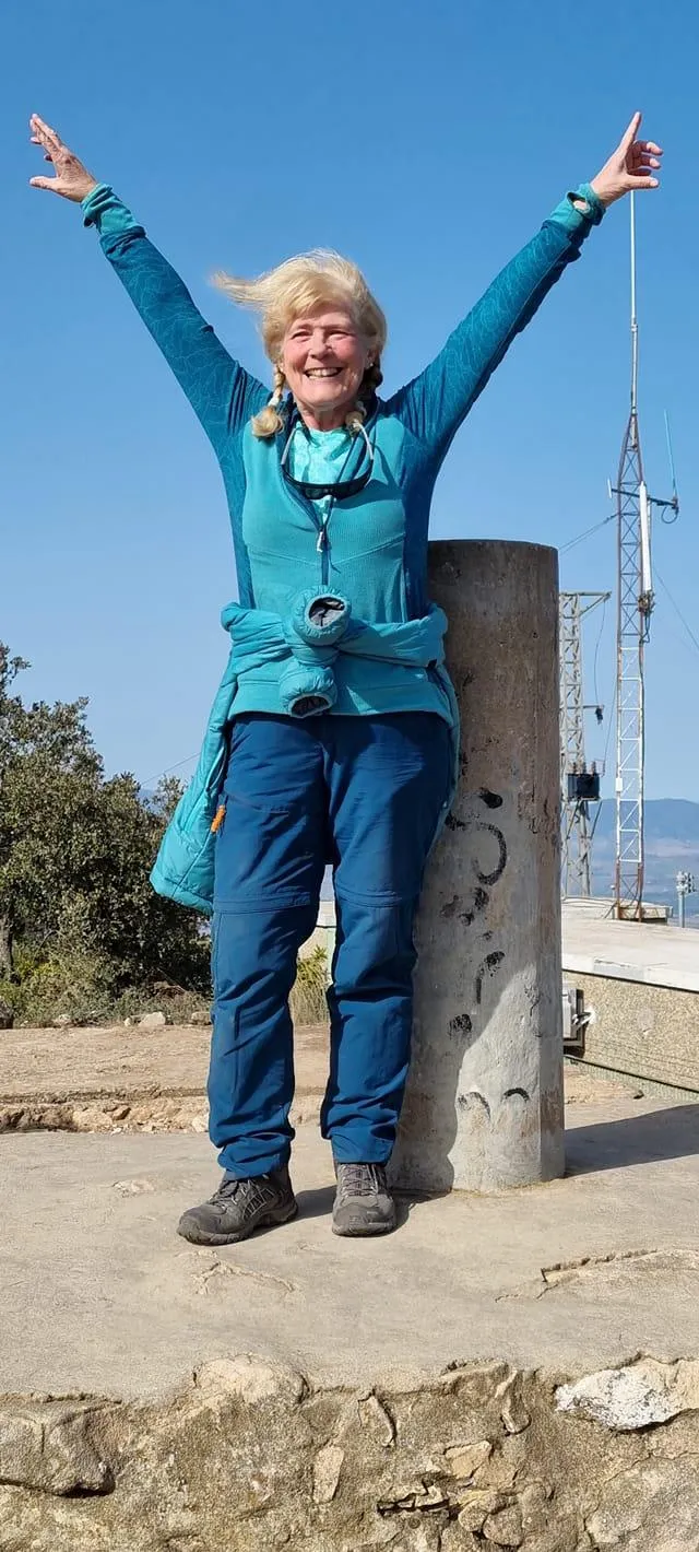
The summit featured a white meteorological ball and the locals have therefore nicknamed the summit ‘La Bola’ – it was useful to see this huge signpost of where we were headed. The last section towards la bola zig-zagged and was a pleasant hike, then we joined a made up road that took us to la bola where, of course, there was a lot of celebrating and lots of photos taken.
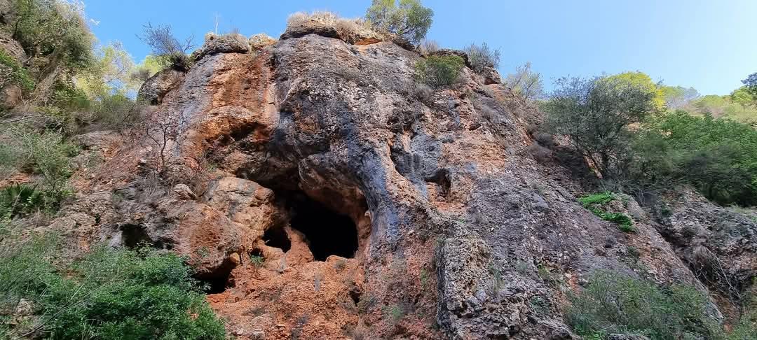
The first part of the descent was back the way we came and then we branched off for a circular loop back to the village.
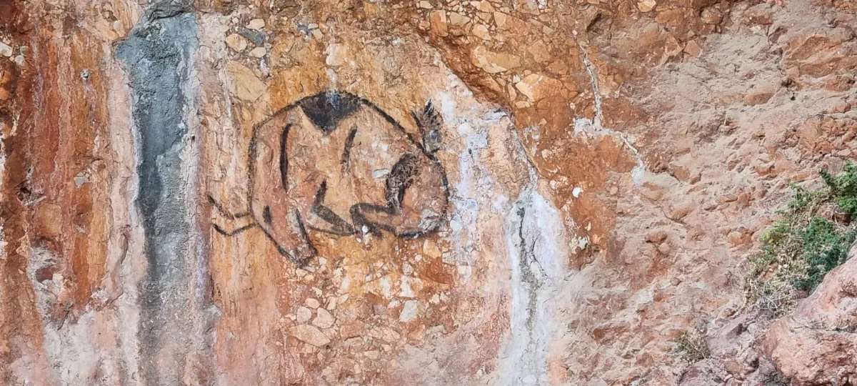
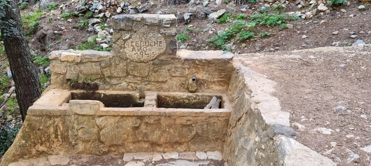
This route took us by some amazing caves, with cave paintings which were really cool as well as what looked like an ancient well.
It really was a lovely route and one I would highly recommend. We took our time, so it took us a total of 6 hours and 51 minutes to cover the 15.67 km but it really didn’t feel that long and we finished feeling very happy and pleased with ourselves.
I felt ready for my final pre-Kili challenge of Mulhacen.
#Atrévete!